Part of my ongoing coverage of the 2026 Coastal Bend.
What are the additional impacts with high gas prices and a drought? Are You Ready?
Hurricane season starts soon. June 1, 2026. And every Coastal Bend resident I’ve talked to in the last two weeks has said some version of the same thing: we’re not ready, are we?
The honest answer is that this year’s hurricane season is different — not because the forecast is unusually scary, but because the conditions we’d normally rely on to weather a storm are themselves under pressure. Our reservoirs are at 8.7% capacity. Gas is at $4 a gallon. The same refineries that make our fuel are themselves competing with us for water. And the same elected leaders who let the water situation reach this point are the ones now reminding residents to “be prepared.”
So let’s actually talk about preparedness — what’s different this year, what to do about it, and what the history of this coast tells us about why it matters.
What the Forecasters Are Saying
Colorado State University’s first 2026 forecast — released last month at the National Tropical Weather Conference on South Padre Island — calls for a slightly below-average Atlantic hurricane season. Thirteen named storms. Six hurricanes. Two major hurricanes (Category 3 or higher). The Gulf Coast as a whole, from the Florida Panhandle to Brownsville, has a 20% chance of a landfalling hurricane this year, compared to the historical average of 27%.
AccuWeather’s outlook is similar — 11 to 16 named storms, 4 to 7 hurricanes, 2 to 4 major hurricanes — and identifies the northern and northeastern Gulf Coast and the Carolinas as the highest-risk areas this year, not the Texas coast specifically.
The temptation is to read those numbers and exhale. Don’t. Forecasters are also warning that the early window — late May through early September — could be unusually active because of warm Gulf waters already in place. They’re also reminding everyone of 1992, which produced only seven named storms — but one of them was Hurricane Andrew, one of the most destructive storms in U.S. history. It only takes one. Tropical Storm Harold made landfall on Padre Island in 2023 in a similarly “quiet” season.
A Coast That Remembers
Before we talk about this year, it’s worth remembering that this coast has been here before. Many times. The Coastal Bend has a long, hard relationship with hurricanes, and any honest preparedness conversation should start there.
- The 1919 Hurricane (Category 3). Made landfall between Baffin Bay and Corpus Christi on September 14. The deadliest hurricane in Coastal Bend history. Generated a 16-foot storm surge — still the highest on record for Corpus Christi. The disaster led directly to construction of the seawall, completed in 1940.
- Hurricane Carla (Category 4), 1961. Landfall at Matagorda Island. The most intense storm to hit the Texas coast in the 20th century. Wind gusts of 80-90 mph reached Corpus Christi. The first time television viewers nationally saw a hurricane reported live, by a young Dan Rather from Galveston.
- Hurricane Beulah (Category 3), 1967. Landfall near the Rio Grande. Wind gusts of 80-100 mph in Corpus Christi, Kingsville, and Aransas Pass. Spawned an unprecedented number of tornadoes across South Texas. Dropped 15-25 inches of rain. Caused record river flooding that still stands in places. 58 deaths.
- Hurricane Celia (Category 4), 1970. Landfall on August 3 near Aransas Pass. Sustained winds of 140 mph at Corpus Christi International Airport. Wind gusts estimated at 180 mph at Aransas Pass and Robstown. 85% of all structures in Corpus Christi damaged. 90% of downtown buildings damaged or destroyed. A third of homes severely damaged or flattened. The name was retired and will never be used again. Celia is the storm that made Coastal Bend property insurance what it is today — the state had to create the Texas Windstorm Insurance Association in response.
- Hurricane Bret (Category 3), 1999. Landfall on Padre Island on August 23. The first major hurricane to hit Texas since Alicia in 1983. A direct hit on the Island, but on a sparsely populated stretch — most of the damage was geographic luck.
- Hurricane Harvey (Category 4), 2017. Landfall east of Rockport on August 26. Winds of 130 mph. Stalled over Texas for days, dropping catastrophic rainfall. 68 deaths in Texas — the highest hurricane death toll in the state since 1919. $125 billion in damages — the costliest tropical cyclone in Texas history. Corpus Christi itself was largely spared the wind damage, but the broader region was reshaped. Eight years later, Rockport is still rebuilding.
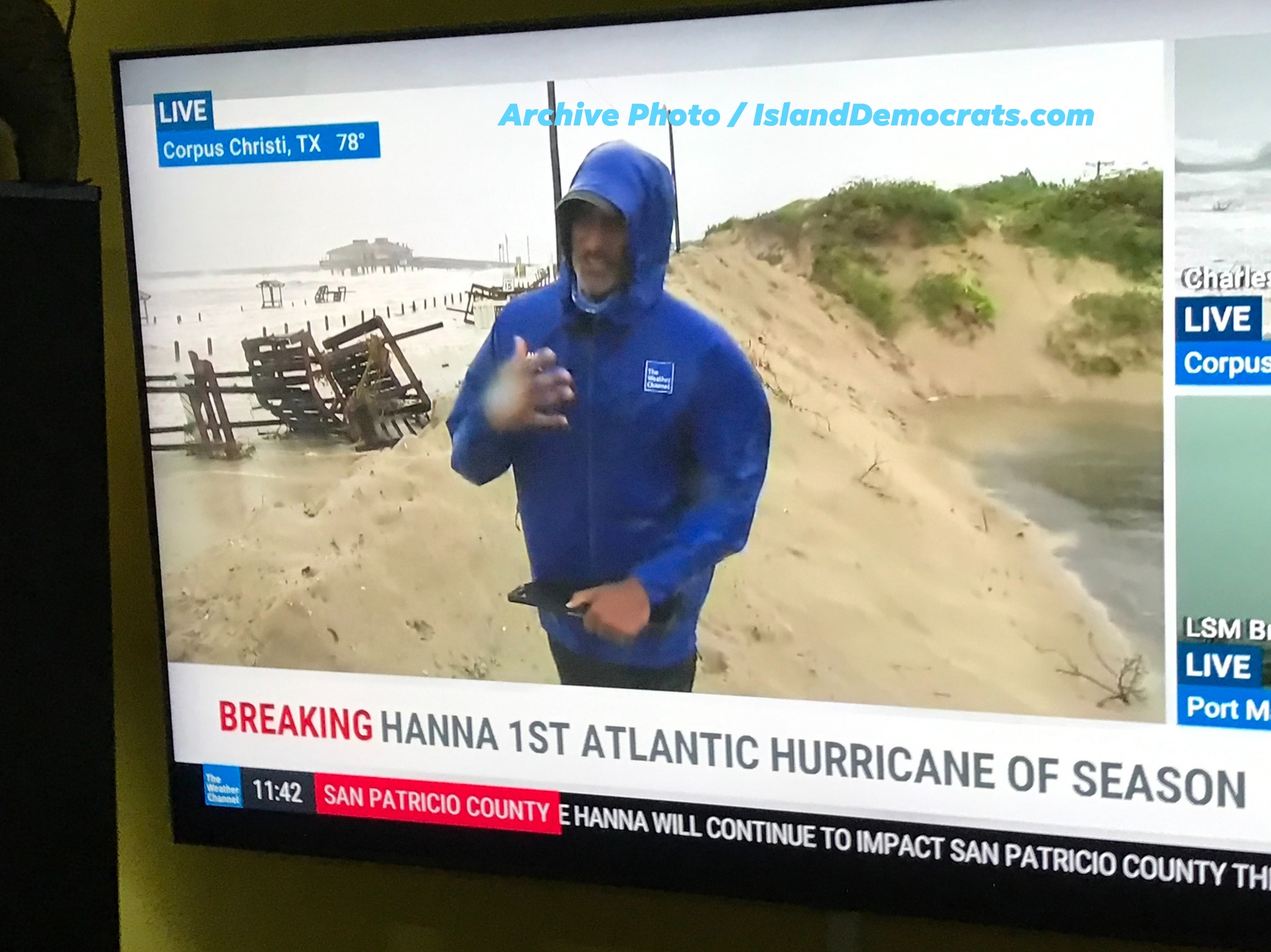
- Tropical Storm Harold, 2023. Landfall on Padre Island on August 22. Winds of 50 mph, with gusts to 67 mph in Loyola Beach and 65 mph in Corpus Christi. 20,000 power outages, including 12,000 AEP customers in Corpus Christi. A reminder that even “minor” storms shut down the grid.
Two patterns are worth noticing. First: the Coastal Bend gets hit. Repeatedly. Across centuries. The question is not if but when, and how prepared we are when it happens. Second: the storms that have shaped this region weren’t always the “biggest” ones forecasters warned about. Celia rapidly intensified in the final 15 hours before landfall, leaving residents with almost no time to prepare. Harold was “just” a tropical storm and still cut power to 20,000 households for days. Harvey didn’t destroy Corpus Christi with wind — it destroyed a region with rain that wouldn’t stop falling.
Preparedness is a habit, not a forecast. You don’t get to wait until the cone shows up over the Coastal Bend to start.
What’s Different in 2026
Here are the conditions every Coastal Bend resident needs to factor into their hurricane preparedness this year — conditions that didn’t exist in any prior season.
The Water Situation
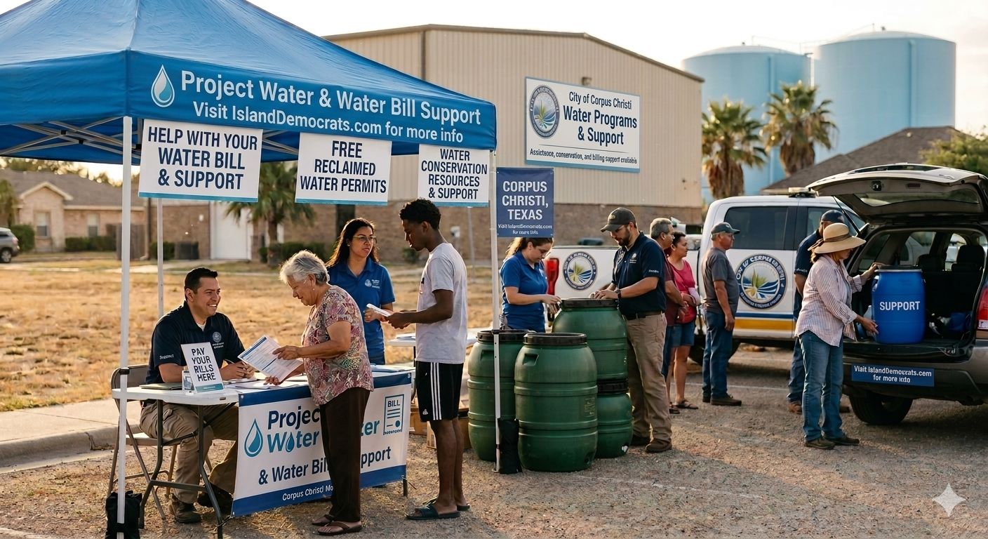
Combined reservoir capacity at Lake Corpus Christi and Choke Canyon Reservoir is at 8.7% as of late April — among the lowest levels ever recorded in the region. The city is now projecting a “Level 1 Water Emergency” by September 2026. The City Council just delayed the vote on the emergency restriction plan that would limit residents to 5,250 gallons per month. About 30% of residential customers currently use more than that.
What this means for hurricane prep:
- Don’t wait until storm warnings to stock bottled water. Coastal Bend HEBs and Strips have already seen heavier-than-normal bottled water demand for months. When a storm threatens, shelves will empty in hours. Stock now. Aim for one gallon per person per day, for at least seven days.
- Plan for slower water restoration after a storm. Citywide water systems already stressed by drought are slower to recover from storm damage. The 2017 standard of “boil water notices for two weeks” may extend longer in 2026 if water mains break under conditions of low system pressure.
- Fill the bathtub and any large containers before a storm arrives. Even with restrictions in place, this remains permitted as personal emergency storage. That water can be used for flushing, washing, and (with proper purification) drinking after a storm.
- Know that Island wells may face new risk. Drought has drawn down the aquifer. A high storm surge can push saltwater into shallow wells, contaminating them. If your home relies on well water, plan for backup.
The Gas Situation
The Texas average gas price is $3.98 as of yesterday, up from $3.26 in March. The national average is $4.48. Coastal Bend prices have tracked the state average closely. The increase is driven primarily by the U.S.-Israel war with Iran, which disrupted Gulf shipping in March, and is unlikely to ease before storm season.
What this means for hurricane prep:
- Evacuation costs more than it used to. A 20-gallon tank now costs about $80 to fill. A typical North Padre Island to San Antonio evacuation is about 150 miles, and many evacuees end up driving further or returning multiple times. Budget at least $200-300 in fuel for a full evacuation cycle.
- Fill up before storm warnings, not after. Lines at gas stations are predictable in the 24 hours before landfall. Pumps run dry. Card systems crash. Keep your tank above half throughout hurricane season this year, not just when there’s a named storm in the Gulf.
- Generator fuel is part of the calculation. A typical residential generator burns 8-15 gallons of gas per day at moderate load. A week-long outage means 60-100 gallons just for the generator. Stored in proper sealed containers with stabilizer, that’s a significant up-front investment now.
- Stay informed on price spikes. Hurricane disruptions to Gulf Coast refineries and pipelines historically push prices up 15-50 cents per gallon in the days following landfall. The price you see at the pump now is likely the lowest you’ll see for the rest of summer.
The Connection Nobody’s Talking About
Here’s the part of this story that no one in city leadership is naming clearly enough. The water shortage is also a fuel shortage waiting to happen.
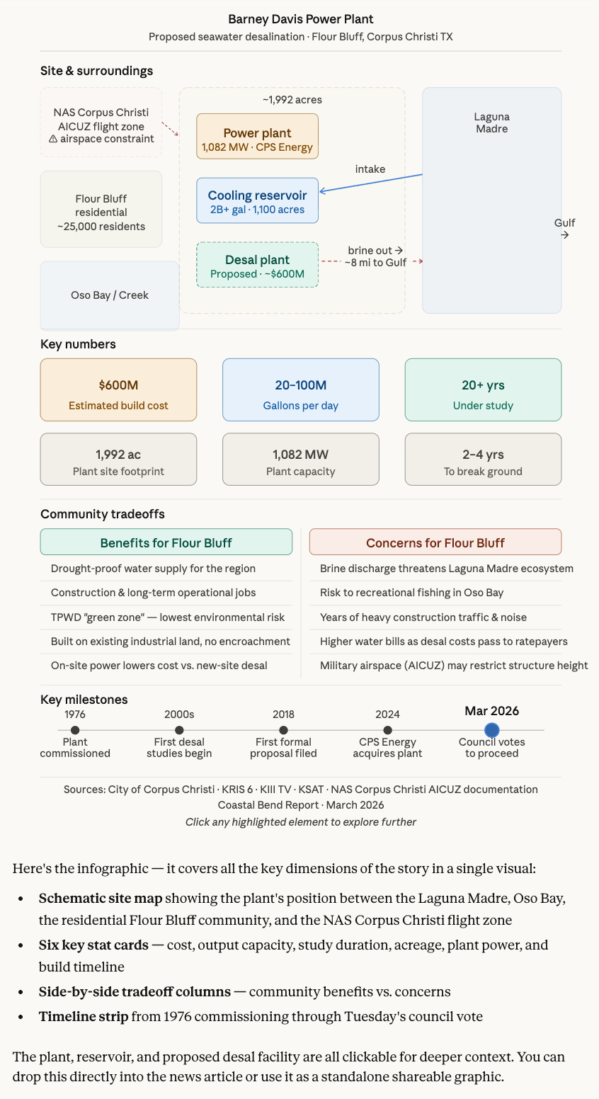
The Coastal Bend’s petrochemical industry — Flint Hills, ExxonMobil, Valero, and others along the Ship Channel — refines fuel for much of Texas. That refining process is enormously water-intensive, requiring millions of gallons per day. According to industry trade groups themselves, if water restrictions force these facilities to slow production or take units offline, fuel supplies tighten across the state, and pump prices climb further.
So the math is this: a storm season hitting the Coastal Bend in 2026 doesn’t just threaten the things we used to worry about — homes, power, transportation. It threatens to cascade through a system that was already brittle before storm season started. Reduced refinery output → tighter Texas fuel supply → higher gas prices → more expensive evacuation → harder recovery → longer rebuilding. Each of these depends on the others.
And the political pressure during a crisis will not favor residents. Industrial water use accounts for a significant share of city water demand. Refineries support 115,000 jobs in the Coastal Bend. When the city has to choose between residential water restrictions and industrial water cuts, the historical pattern is clear: residents lose first.
What to Do This Week
Twenty-six days. That’s the runway. Here’s a concrete to-do list, calibrated for 2026 conditions:
- Stock at least 7 days of bottled water now — one gallon per person per day. Don’t wait for a named storm.
- Keep your gas tank above half all season. The pre-storm rush is when fuel runs out.
- Update your emergency kit. Non-perishable food, first aid, flashlights, batteries, hand-crank radio, prescription medications for at least 14 days, important documents in waterproof bags, cash in small bills.
- Photograph your home, inside and out. Every room. Every closet. Every appliance. Insurance claims after a Coastal Bend storm can take months. The photos you take now are evidence later.
- Confirm your evacuation plan. Where are you going? Who are you going with? What route? Have a backup route. Have a backup destination. The JFK Causeway is the only way off the Island, and it gets slow.
- Sign up for emergency alerts from Nueces County (NuecesAlerts.com) and the City of Corpus Christi.
- Review your homeowner’s and flood insurance policies. Texas Windstorm Insurance Association coverage requires a separate policy from your regular homeowner’s. Policies cannot be initiated once a storm enters the Gulf — you need them in place before the season begins.
- If you have a generator, test it now. If you don’t, decide whether you need one before stores sell out in late August.
- Help a neighbor. Especially seniors, especially those without family nearby, especially renters new to the Island. Hurricane preparedness is a community thing or it’s nothing.
- Pay attention to who shows up. Local elected officials make decisions about water allocation, evacuation routes, emergency response funding, and post-storm recovery long before any storm arrives. Notice the ones doing the work now — they’re the ones who’ll make a difference in November.
Questions Worth Asking Our Leaders
Three questions worth putting to anyone running for office locally — or anyone holding office now:
- What is the city’s plan if a hurricane makes landfall during a Level 1 Water Emergency? The drought is one crisis. A storm during a drought is a different crisis. Has anyone modeled it?
- How will industrial water allocation be balanced against residential needs during a post-storm recovery? If residents are limited to 5,250 gallons per month while refineries continue at full capacity, what’s the principle?
- What’s being done to ensure JFK Causeway evacuation capacity is adequate? The Causeway is the only evacuation route off North Padre Island. It is also aging, occasionally closed for repairs, and untested under modern evacuation traffic.
A Closing Note
The Coastal Bend has been through worse than this. Survivors of the 1919 storm rebuilt and built a seawall. Survivors of Celia rebuilt 85% of a damaged city. Survivors of Harvey are still rebuilding Rockport eight years later. We’re not strangers to recovery here.
What’s different in 2026 is that we’re being asked to prepare for storm season while the foundations of preparation — water, fuel, infrastructure — are themselves under stress. That’s not a reason to despair. It’s a reason to take preparation more seriously than usual, to lean on each other harder, and to be honest about the conditions we’re in instead of pretending it’s a normal year.
Stock the water. Fill the tank. Help the neighbors. Pay attention to the people in office. And start now, not in August.
Twenty-six days.
Want to be part of the conversation? Join us at Monday Covfefe at Island Starbucks (10 AM, every week), or call 361-548-6804. We’re talking water, hurricane prep, and what comes next every week.
More from islanddemocrats.com: How Corpus Christi Got Here · What Other Cities Did to Survive
#NorthPadreIsland #IslandDems #CoastalBend #HurricanePrep #WaterCrisis #2026